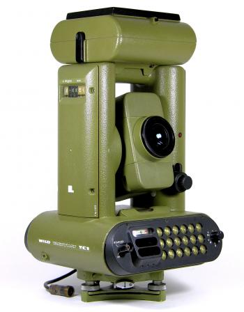
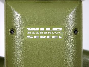
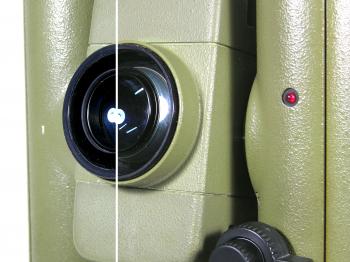
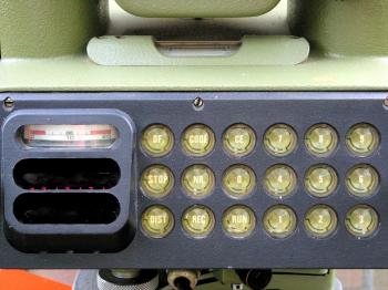
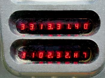
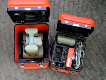
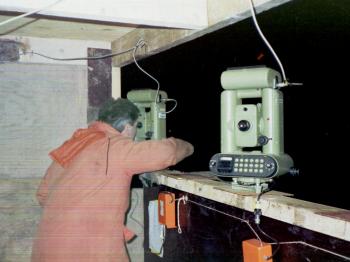
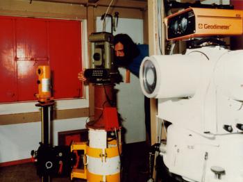
1980 Wild Heerbrugg TC1 total stationI was given this total station in 2009. According to the last owner and based on the manual the instrument was made around 1980 by the Swiss company Wild Heerbrugg. Development The Wild TC1 was developed in 1978 and was the first total station that measured distances coaxial (so through or rather around the telescope as the telescope consists of two concentric lenses, the outer one of which was used to measure distances, see figure 8). Before the TC1 total stations measured the distance using separate optics above the telescope, causing distance errors when observing at steep vertical angles. The concept of coaxial distance measurements came from the 1970s HP 3810A, but that instrument still used a separate scope for aiming. Using a coaxial EDM, like in the TC1, meant the same point that was used to observe the vertical angle at was used to measure the slope distance to. As can be told by the logo on the side of the instrument (see figure 4) the TC1 was a combined development of Wild Heerbrugg and Sercel, a well known manufacturer of various types of positioning systems as Syledis and high-end GPS receivers. Sercel has been responsible for various EDMs that were produced by Wild including the one on the TC1.1 Their cooperation was however not solely confined to EDMs, but also in other fields as aerial photogrammetry.2 The TC1 was capable of measuring horizontal and vertical angles and slope distances, which could be stored using an accessory cassette tape recorder that was mounted on top of the instrument (see figure 3). For comparison: the period Kern E1 in the collection was an electronic theodolite with a detachable distance meter and external storage. The Wild TC1 had all parts fully integrated in one instrument (although it has to be said that the recorder was detachable). Provenance In 1980 the instrument was - together with several others - purchased by DOSbouw (the joint venture that built the Dutch Delta Works in the southern province of Zeeland). They were used for standard land surveying but also served as a back-up for the AGA/Minilir system (see figure 18 and figure 19) to position the vessels Ostrea, Macoma and Cardium. In order to do the latter the cassette recorder units were modified, replacing the recorder by telemetry (see figure 14), which allowed the measured data to be received on board of them. The TC1 was also used for an independent position check for the Ostrea. For this dedicated software was written on a HP85 computer that allowed to monitor the vessel in 3D. According the evaluation report the instruments gave little trouble and were popular among the operators due their ease of use.3 After the Delta Works the instruments were passed on to the Survey Department (Meetkundige Dienst) of the Dutch government. This is when they received their inventory numbers and by sheer coincidence the one showed here receved the first of them labelled "TC 1/1" (see figure 6). Some of the six TC1s went to the field organizations, while three of them ended up at the Mariene Geodesie department (GAM) where I and the previous owner of the instrument used to work.4 Here the TC1 was used for vessel offset measurements and the submersion of tunnel elements of the Zeeburgertunnel (1987-1989, see figure 16) and Willemspoortunnel (1990-1991, single "s" is the official spelling, for picture see figure 17). In August 1998 the previous owner was given the instrument when he left the Dutch Survey Department. In his spare time he used it several times to help the rowing club where his son was an active member, setting out the finish line and renovating the shore protection. Last year (2008) the instrument stopped functioning after which he decided to donate it to my collection. Accuracy Being an electronic total station the TC1 can be used in sexagesimal degrees (360 divisions in a full circle) and gon/grad mode (400 divisions in a full circle) by flipping a switch (see figure 7). The instrument has a compensator for the vertical circle and has an angular resolution of 3.24" (0.0011 gon) while the standard deviation of an observation in two faces is about 2" (0.0006 gon) horizontally and 3" (0.0010 gon) vertically. According to the specifications the distance measurements have an accuracy of 0.005m (up to 1400 metres with 11 prisms and 8 seconds measuring time) or 0.005 - 0.015m (up to 2000 metres with 11 prisms and 15 seconds measuring time). Horizontal and vertical distances can automatically be calculated and are corrected for refraction (k=0.13) and ppm which can be set with a switch on the side of the instrument. At the time it first saw the market the Wild TC1 would have cost roughly fl.50,000,-. The instrument The instrument came complete with its modified cassette tape recorder, power supply, transportation boxes, and various small accessories like the reticle illumination (see figure 9 and figure 15). A period Wild Heerbrugg tripod was already in the collection to make the set complete. Sadly enough the TC1 stopped functioning properly in 2008 (see figure 11), so I could not put it to the test. Even an attempt by one of the Leica certified service stations here in the Netherlands did not get it back into working order. On the scales it reaches a whopping 10 kilograms (14.5 kilograms with the box). The cassette recorder comes in a separate box and adds another few kilograms to it. Compared to this my Leica TCRA1101 total station I use for my work is a lightweight at only 6 kilograms (10kg with the box). Notes[1]: See the Distance meters page at The Virtual Archive of Wild-Heerbrugg[2]: R. Brossier, C. Million, A. Reynes, "Photogrammetric Applications of Sercel GPS TRSS-B Receiver at Institut Geographique National - France", (St. Mande, 1988). [3]: DOSbouw/RWS, Evaluatie MACOSDOS survey, v 2.1, February 1984, p.55. [4]: The previous owner started working at the Survey Department straight after the Delta Works were finished, while I entered in 1996 and left in 2000. Figure reference figure 16 - figure 19: collection A.P.M. Pieters. If you have any questions and/or remarks please let me know. |
Surveyor's crosses... Geodetic Sextants... Theodolites... Total Stations... Levels... Standards... Tools... Firms...
1970s HP 3810A 1980 SAT AGA-Minilir 1980 Wild TC1 1980s Zeiss Elta 20 1984 Kern E1 1986 Geodimeter System 400 1992 Krupp Atlas PolarTrack 1999 Leica TCRA 1101


