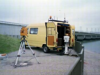
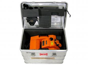
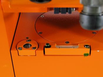
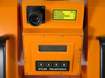
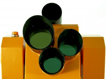
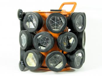
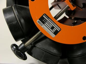
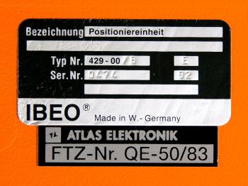
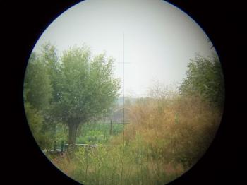
1992 Krupp Atlas PolarTrackIn 2012 the successor of the Fennel/Minilir was donated to my collection. It concerns the Krupp Atlas PolarTrack, a polar auto-tracking system similar to the Fennel/Minilir. The PolarTrack was developed in the 1980s by Krupp Atlas, well known in the hydrographic surveying community for producing the best echo sounders of that era: the Deso 20, 22 and 25. The forerunner of the PolarTrack, the PolarFix, was created by them in 1982. A former Krupp Atlas employee took the ideas from Krupp Atlas to Navitronic AS in Aarhus, Denmark. Later a consortium of IBEO, Hamburg (the manufacturer of the Fennel EDM on top of the Minilir) and Navitronic, created the Navitrak 1000.1 In the years following IBEO joined Krupp Atlas to create the PolarTrack. Given its almost identical design (see figure 16), its absence next to the Navitrak 1000 and PolarFix in the 1989 work Laser Surveying and the 1989 PolarTrack specsheet (figure 17), the Navitrak was followed by the PolarTrack by the end of the 1980s. The PolarTrack had a number of advantages over the Fennel/Minilir. Whereas the Minilir needs a heat source to track its target, the PolarTrack only needs a passive retroreflective prism to be able to do the same. The vertical circle is automatically compensated2 and instead of requiring 220 volts to operate it only requires 12 volts and can thus operate on batteries. In addition to that it is only half the weight and about a third the volume and with a price tag of fl.165,000.- roughly a third of the price of the Fennel/Minilir. Although the PolarTrack is a purpose built surveying instrument it is not a conventional total station and, alike the Minilir, one cannot look through the same telescope as the instrument takes its observations through. Instead there are three additional aiming aids (see figure 11); an optical bead like on most modern total stations (figure 18), a small eccentric built-in telescope, and an optional large rifle-type telescope mounted on top of the instrument (see figure 2 where the bead sits on top of the rifle sight and the ocular of the internal telescope can be seen just below it). The telescopes have two different magnifications and different stadia hairs (see figure 19 and figure 20). Provenance This particular PolarTrack came from the Maritime Institute Willem Barentsz. on Terschelling, the Netherlands where it was used at the hydrography course (now Ocean Technology). It was donated to the institute by the Dutch governmental survey department. Over the years the instrument became old-fashioned and had not been used since the mid 2000s. Finally the institute wanted to scrap the instrument, which was prevented by donating it to my collection in 2012. Initially it came without its original tripod, but that was donated in 2013 by the Dutch government to complete the set. Accuracy When studying the specsheet it becomes clear that the PolarTrack is not meant to be a true geodetic instrument. Accuracies are given in metres rather than in angular units. According to the specs the horizontal accuracy is approximately 10cm for the first kilometre range, followed by 10cm + 5cm per kilometre for ranges up to 5 kilometres. This translates to a horizontal accuracy of about 0.003 degrees. Vertically the instrument is equally accurate when used in dynamic mode, while in static mode it was almost twice as accurate (5cm + 5cm/km). The accuracy of the EDM is only given for foggy weather and comes to 15cm + 0.5cm/km. Under favourable conditions the EDM works up to 10 kilometres. The instrumentAs mentioned above the instrument was reunited with its typical original tripod. In addition to that it came in its original case, with all sun shades, filters and original tribrach (the instrument can be used with and without it, see figure 4, figure 5 and figure 21). Although much lighter than the Minilir the PolarTrack still weighs a lot: 20kg for the instrument, 18kg for the power/telemetry box, and 12kg for the tripod. In its original case the instrument even weighs 27kg. Initially the PolarTrack was tested against the Fennel/Minilir and came into use here in the Netherlands around 1992-1993. It became however soon outdated with the advent of robotic total stations, like the Leica TCRA1101, and accurate dGPS systems before the end of the decade. Notes[1]: W.F. Price, J. Uren, Laser Surveying, (London 1989), pp.213-218.[2]: RWS Meetkundige Dienst, Polartrack, Richtlijnen voor het Opstellen en Oriënteren van het Walstation, (Delft 1994) If you have any questions and/or remarks please let me know. |
Surveyor's crosses... Geodetic Sextants... Theodolites... Total Stations... Levels... Standards... Tools... Firms...
1970s HP 3810A 1980 SAT AGA-Minilir 1980 Wild TC1 1980s Zeiss Elta 20 1984 Kern E1 1986 Geodimeter System 400 1992 Krupp Atlas PolarTrack 1999 Leica TCRA 1101


